World Map "Nova Totius Terrarum Orbis Geographica Ac Hydrographica Tabula a Pet Kaerio "
Van Den Keere's hand colored decorative map of the World was first issued in 1608, it shows the then known regions of Europe, Africa, Asia, America and Terra Australis Incognita (Latin for "the unknown land of the South"), the large continent on the bottom of the map. In the 17th century it was a hypothetical continent.
The map has decorative embellishments showing personified symbols of the planets Mercury, Venus, Mars, Jupiter, Saturn and the Moon on top; the left side panel shows the four elements, the right side panel the four seasons; the bottom panel is decorated with the Seven Wonders of the Ancient World, from left to right: the Hanging Gardens of Babylon, the Colossus of Rhodes, Great Pyramid of Giza, Mausoleum of Halicarnassus (present Bodrum, Turkey), Temple of Artemis (also known as the Temple of Diana) situated at Ephesus (near the modern town of Selçuk in present-day Turkey); Statue of Zeus at Olympia and the Lighthouse of Alexandria.
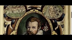
Pieter van den Keere (also Peter Kaerius) was born in 1570/1571 in the city of Gent in the Netherlands. He was a cartographer. engraver and publisher.