400 year old Sahara Desert, or why people forgot everything they knew about Africa

"All right, Beatrice, there was no alien. The flash of light you saw in the sky was not a UFO. Swamp gas from a weather balloon was trapped in a thermal pocket and reflected the light from Venus." - Kay, MIB.

I always thought that Sahara Desert was thousands of years old. Of course, the official version confirmed it in the most scientific way possible, "During the last glacial period, the Sahara was much larger than it is today, extending south beyond its current boundaries. The end of the glacial period brought more rain to the Sahara, from about 8000 BC to 6000 BC, perhaps because of low pressure areas over the collapsing ice sheets to the north. Once the ice sheets were gone, the northern Sahara dried out. In the southern Sahara, the drying trend was initially counteracted by the monsoon, which brought rain further north than it does today. By around 4200 BC, however, the monsoon retreated south to approximately where it is today, leading to the gradual desertification of the Sahara. The Sahara is now as dry as it was about 13,000 years ago."

Sahara_satellite_hires.jpg

Scientific American reports that they updated the age of the Sahara Desert to a whooping 3,000,000 years old.

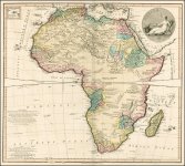
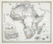
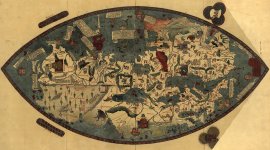
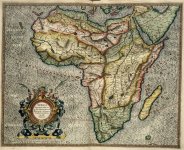
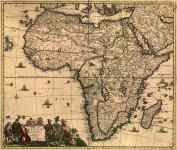
Apparently, some cartographers of the "not so distant" past, failed to consult with the scientists of the 20th and 21st centuries. Somehow, in the 16th, and 17th centuries the map makers forgot to update their maps with the wisdom of the scientists of the future. Instead they depicted the Sahara Desert the way it was back then, 400 - 450 years ago. And what a beautiful site it was: lakes, rivers, cities, people, animals. Everything but the Great Egyptian Pyramids, so to speak.

Years: 1475 - 1570 - 1595 - 1642 -1658 - 1688
1475_africa_map_toscanelli.jpg 1570-Africae_tabula_nova.jpg 1595-Mercator_Africa_037.jpg 1642 Nova Totius Terrarum Orbis Geographica Ac Hydrographica Tabula.jpg 1658_africa_map.jpg 1688_africa_map_original.jpg
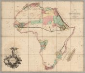
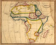
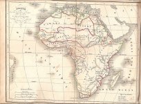
And then, all over sudden people got dumber. Well, either dumber, or the Mankind suffered some serious case of global amnesia. For whatever reason the Africa had to be re-discovered all over again. Blank uncharted territories cover the continent of Africa in the areas which were well known before.

Years: 1782 - 1802 - 1812 - 1842 - 1853 - 1860
1782_africa_map.jpg 1802_Africa.jpg 1812-Africa_map.jpg 1842_africa.jpg Carte_afrique_1853.jpg 1860-Africa-white-spots_2.jpg

1592 Prioris Hemisphaerii, totiusque Geographici
Prioris Hemisphaerii, totiusque Geographici.jpg

1592 Africa
Today's scientists give us tons of false information (read BS) about so many things, that sometimes it's hard to figure out which part could be trusted. I choose to trust the cartographers who put these maps together at the time when they were alive, just like I trust Piranesi with what he depicted for us. Coincidentally, Piranesi lived at about the same time when the transformations started to happen.

Dear scientist: It's probably fun sitting in some lab, building a "scientific" model of the formation of the planet, as long as you do not push it onto people through educational channels. And if your models do not match eyewitness accounts, than may be you should check your data (hint: you can start with maps above). When you teach people about what happened millions of years ago, yet have no clue about a few hundred years back... you probably have an agenda.
  • The definition of historical science is using knowledge that is already currently known to tell the story of what happened in the past.
If reading documents, researching, investigating and being truthful about contents, interpretations and findings qualifies as science, than I guess it is. But this interpretation does not appear to fit historians I know.

Google Books Ngram: Sahara
sahara_desert_ngram.jpg


The Sahara Desert
I do not speak or read Latin, but using Google Translate is not that hard. Desertum translates to desert. Now we simply need to figure out what a desert is. We are lucky, for Geology.COM makes this question easy to answer.

What is desert?
A desert is a landscape or region that receives very little precipitation - less than 250 mm per year (about ten inches). Approximately 1/3 of Earth's land surface is a desert. There are four different types of deserts based upon their geographic situation:
  1. Polar deserts
  2. Subtropical deserts
  3. Cold winter deserts
  4. Cool coastal deserts
The two largest deserts on Earth are in the polar areas.
  1. Antarctica
    • The Antarctic Polar Desert covers the continent of Antarctica and has a size of about 5.5 million square miles.
  2. Arctic
    • The second-largest desert is the Arctic Polar Desert. It extends over parts of Alaska, Canada, Greenland, Iceland, Norway, Sweden, Finland, and Russia. It has a surface area of about 5.4 million square miles.
As shown on the map below, deserts occur on all of Earth's continents.

desert-map.jpg

When most people think of a desert, they imagine a landscape covered with sand and sand dunes. Although many deserts are sand-covered, most are not. Many desert landscapes are rocky surfaces. They are rocky because any sand-size or smaller particles on the surface are quickly blown away. Rocky deserts are barren wind-swept landscapes.

To keep things simple, and based on the above official information, we can conclude that:
  • Desert = snow
  • Desert = tundra
  • Desert = sand
I doubt that ancients ran around with a ruler trying to determine what areas of this world qualify to be called deserts. This 250 mm standard most likely belongs to our approximate time frame. That leaves us with the word "desert", and what meaning of this word prompted to classify certain areas as deserts.

This is where we get a chance to use Google and Google Translate again:
Now let's see how Merriam-Webster defines both noun and verb forms of the word "desert".
  • Noun
    1. land with usually sparse vegetation
    2. an area of water apparently devoid of life
    3. a desolate or forbidding area
    4. archaic: a wild uninhabited and uncultivated tract
  • Verb
    1. to withdraw from or leave usually without intent to return
    2. to leave in the lurch
    3. to abandon (military service) without leave
As we can see, the presence of sand is not a requirement for the area to be called a desert. In other words the fact that this "desertum" word, in its various forms, is present on some of the maps, does not place mountains of sand in the areas where we can see them at today.

  • 8. Tachort (river), rises from certain Mountains near Libya, waters the Town of that Name, and runs through a Forest into the Lake.
    • How many rivers, lakes and forests do we know today in this part of Libya?
Here is one additional map with Techort on it.

There are other rivers, lakes and places from the above maps mentioned in this book. As far as I understand this book is a translation from Latin. The Latin version predates 1714 English copy.


This is what the area might have looked like in color prior to whatever buried it under the "sands of timr". The map is dated with 1592. Dates are complicated, and if you hang around, and do some proper blog reading you will understand why. One thing I'm convinced in, this map is not showing Africa millions of years ago. I'd estimate we are seeing 1400-1670 time frame on the conventional time scale.


There is a reason why maps changed, and the truth is not within the common narrative.


The official description of the below 1802 map: One of the first maps of Africa to show the true state of geographical knowledge of the continent, hence the vast areas of the map with no information - this was Arrowsmith's style when he mapped Africa, the America's and other parts of the world where geographic information was both unknown and evolving.

1635-1802_African_Vanished_Cities.jpg

1635 - 1802

I do not mind our Sahara desert being millions/thousands of years old. Unfortunately, our scientific community has no proof of that. Such dating relies heavily on the power of the educational system, lying/misleading historians and public ignorance.
  • Example of the lies: look up the official explanation of why African maps between 1500-1800 do not correspond to what we are used seeing today.
Sahara Desert is clearly not thousands of years old. Why we are being fed this false information is a totally different topic. Whatever initially happened in the 18th century, changed the face of this planet in multiple locations. Sahara Desert is just one of those.

The Eye of Sahara and Weapons of Mass Destruction
It appears that we have hundreds of different size craters spread out through out the entire African continent. None of those is bigger then the mysterious Eye of Sahara. The formation is 25 miles in diameter. Our "scientists" claim that it was formed 100 millions of years ago. Considering that this formation is not on the maps predating the 19th century, we could make our own conclusions. I can.

eye_of_sahara.jpg

Then we have a bunch of smaller craters all over the African Continent. As an example I could use the 8 mile wide Aorounga Crater claimed to be 345 millions years old.

aorounga_crater_1.jpg

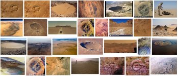
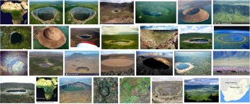
There are multiple others, named and unnamed out there: Tenoumer Crater, Aouelloul Crater, Ouarkziz Crater, Talemzane Crater, Tin Bider Crater, Aorounga Crater, Amguid Crater... and there are more. Here are Google assisted Sahara Craters and African Craters.

sahara_craters.jpg african_craters.jpg


KD: It appears someone very powerful whacked the entire African Continent a few hundred years ago. Hundreds of cities and towns were destroyed. Millions, if not billions of people could have been killed in the process. Yet we are being fed a bunch of baloney about millions of years, and meteorite craters. Be dull, or be attentive.

Further reading:
Yes, this World has a secret to keep...
 
I have no doubt the Sahara, Antarctica, and other places like them will yield up some physical evidence of the civilizations buried there one day. Hopefully that day is before another part of our world is again buried by the same kind of cataclysm. Can you imagine if all the effort of academia were dedicated to uncovering Earth and humanity's *real* history? Either way with the sheer density of anomalies to the accepted historical timeline that you and other researchers are finding, it's obvious a mind boggling amount of history is being actively suppressed.

Thanks to LIDAR they're now finding cities buried under the Amazon. Smithsonianmag: Achaeologists find Amazon villages laid out like a clock face

LIDAR wouldn't work for showing what might be under the Sahara. But you know what might? Ground penetrating radar.
 
I have no doubt the Sahara, Antarctica, and other places like them will yield up some physical evidence of the civilizations buried there one day.
Definitely many cities and civilizations were buried under all deserts and I'd say civilizations not like us. Probably comet hit the earth and a lot of blasts covered the land with dust turned into sand. And it happened not long ago, probably 180-250 years ago.
 
Last edited:
Just curious, what do you mean?
Let's look at ancient buildings all over the world. Who built them? People like us today? With all modern technologies today we can't build anything like this. What is built today can hardly last a century but ancient buildings still stand. People are not like us meant different sizes, different abilities - Gods, half gods, titans, giants. If we look at doors or windows of these masterpieces all of them are enormous sizes. Sizes are for huge size people. I understand it sounds weird, funny, bizarre but probably ancient Greek mythology was not mythology and not Greek one.
 
Thank you for this interesting article. During my google earth treks to find ruins and infrastructure of the old world, i did look at Africa quite a lot, but i never had a detailed topographic map like you have shown. Tnx for that. From my studies of Africa on google earth i have found that there are massive flood scars all over the northern half of Africa. They are most noticeable in the NW and East of the continent. It's like a massive body of water started travelling from the center of Africa and spilled in the Atlantic ocean. I thought these were the scars from an ancient global flood, like Noah's flood, but now i find out that it happened in the latest reset. Looks like it wasn;t just a big chill, it was a flood disaster too.
In my opinion, the Sahara basin was once a large in-land sea or lake that got drier and dried during the millennia as the planet got warmer. It did have a lot of rivers and lakes/oases, but it was still a sandy place, as is mentioned in that old book.
I have to say i don;t think the Richat structure was Atlantis (the ruins of the Atlantis empire lie in the sunken landmass under the Azore islands), but it was one of the largest cities of western Africa. After studying the Africae Tabula Nova map and making a reference to google earth's longitude grid (i love old maps that have a longitude grid because i can use that to find ancient cities and mark them on modern maps), i can relate that the Richat structure was the city of Gandia. Also i think Aorounga crater was the city of Gheogan in Nubia. These might not be craters, they could just have been some beautiful circular cities surrounded by a huge round water basin. Water was still very precious in the old Sahara, so having a huge artificial reservoir built around your city would be a great idea. The flood scarring evidence that we can see on any satellite maps seems to indicate that a large volume of water was dislocated from the Mediterranean sea and raced across the continent in a SW motion. What the hell happened to these people? Was it another tectonic cataclysm like the destruction of Atlantis or was it some kind of global flood?
I have watched a short documentary about a tourist that visited the middle of the Richat. He had no clue about the old world but in the few good clips he filmed, i could see distinct diorite and black marble monoblocks and floor tiles among the rubble. Nature does not make right angles and that is how you can detect ancient ruins or giant fortresses. Imagine how great the tidal wave must have been to reduce a city like Memphis to tiny rubble...
The only reason the south of Africa was spared is because the tidal wave was stopped by the mountains of central-western Africa. Even with all the sand and flood damage, if you follow the Niger river and zoom in on a sat map, you will see ruins of large cities and their infrastructure. Hundreds of square kilometers of farm plots, roads, canals and houses. I have found one of the towns that was rebuilt from the ruins, Timbuktu (Tombotu on the old map) and nowadays only the center of it is populated, but if you zoom out you can see the ruins of the old city stretching for miles.

Given how many large cities were destroyed in the cataclysm or have been covered by snow i can honestly say that the tartarian civilization was somewhere around 8 billion or more. Our little civ is a mere fraction of that now...
We are the lost children of history and we continue to sleep.

Africae_tabula_nova - flood study copy.jpg
I will add my study of the north african flood scarring as it appears on modern maps.
 
Thank you for this interesting article. During my google earth treks to find ruins and infrastructure of the old world, i did look at Africa quite a lot, but i never had a detailed topographic map like you have shown. Tnx for that. From my studies of Africa on google earth i have found that there are massive flood scars all over the northern half of Africa. They are most noticeable in the NW and East of the continent. It's like a massive body of water started travelling from the center of Africa and spilled in the Atlantic ocean. I thought these were the scars from an ancient global flood, like Noah's flood, but now i find out that it happened in the latest reset. Looks like it wasn;t just a big chill, it was a flood disaster too.
In my opinion, the Sahara basin was once a large in-land sea or lake that got drier and dried during the millennia as the planet got warmer. It did have a lot of rivers and lakes/oases, but it was still a sandy place, as is mentioned in that old book.
I agree with most of you said. Also the craters - cities. What i disagree - that Africa was always sandy. I think that your directions to floods in Africa is right, but you didn't used a bigger picture - literally. Some time ago i found interesting satellite produced picture - biggest and most detailed picture of earth.

The bigger picture im talking is that one:

1623956223832.jpg

Link to original interactive map: Sentinel-2 cloudless map of the world by EOX

Now lets bet, where the biggest "stone" felt on the earth. Its so visible, that nobody pay attention. Area of Himalayas - can you see the 3 impact points? And yes, all the Africa was "washed" out. Cities, ground, people - everything. The tidal wave must be like 2-3000 meters high? If you open google earth, you can rotate the earth and can see the half round silts in the oceans in the direction of hit. Thats why the magnetic poles are still moving - the earth is still "shaking" after that hit. When it happens? I believe around 1000 years ago. All the life on earth was annihilated - only few "islands" of life survived. The plunder and robbing became normal. There you have all the pictures of cannibalism. Anyway - the islands of life - independent - became the cities - city states - but most successful robbers start to war for a world domination. The other clue for me was this picture:

1623956882076.jpg

Thanks to Korben. Pay attention to the flag. Then check the nowadays coat of arms of Russia - and also check the coat of arms of "Hanseatic league". Who was the opposite side to Hanseatic league - i don't know - but my guess will be old "german" aristocrat families. And approx. 200 - 300 years ago the war was over. The rest was only the wiping the history and colonization of the rest of the world. There is no multi-polar world these days, only the most successful robber is ruling the world with no mercy and with only one target - to keep power.
 
I did go to the Sahara desert when I was young (90's) on a camel.
The same way it amazes me how the Dutch beach became so... sandy.
I mean most beaches are rocky and partly sand. And in the Netherlands we have sandy beach and dunes....
The Sahara desert was kilometers filled with sand just like we see near the sea? Really fine sand.
It might fit into the above story that there was once a flood kind of happening.

Even a more stupid thing: we are running out of sand on earth (for buildings)
So, we have a whole desert filled with sand, but that is not the right sand? It is too "fine" (?)
 
This is a fascinating article and thanks very much from this new member. I notice in the map "Same 1574 Map" that there are clear place names such as SELIN and TELGIRA. Can anyone find any modern references to these or any other locations near them on the map?
 
Every single river in Europe is surrounded by sandy watersides. Even in my city - small one. I believe that all the mountains was created as the effect of that hit. The earth cracked and the mountains are these cracks. Just open the ggl earth and let you imagination work. And that's only 1000 years ago.
 
I have no doubt the Sahara, Antarctica, and other places like them will yield up some physical evidence of the civilizations buried there one day. Hopefully that day is before another part of our world is again buried by the same kind of cataclysm. Can you imagine if all the effort of academia were dedicated to uncovering Earth and humanity's *real* history? Either way with the sheer density of anomalies to the accepted historical timeline that you and other researchers are finding, it's obvious a mind boggling amount of history is being actively suppressed.

Thanks to LIDAR they're now finding cities buried under the Amazon. Smithsonianmag: Achaeologists find Amazon villages laid out like a clock face

LIDAR wouldn't work for showing what might be under the Sahara. But you know what might? Ground penetrating radar. There are artifacts buried all over the planet.
There are artifacts buried or standing in open sight, all over this planet. It cost a hefty sum to mount an expedition then put your team in the field. There are numerous artifacts where their location is known, but the problems to retrieve sometimes is overwhelming. My best opinion, the earth gets hit often with the electromagnet discharge, that KD, talks about. War with energies we do not understand yet and asteroid hits could account for the remainder. Nothing is as portrayed. .
 
"Now lets bet, where the biggest "stone" felt on the earth. Its so visible, that nobody pay attention. Area of Himalayas - can you see the 3 impact points? And yes, all the Africa was "washed" out. Cities, ground, people - everything. The tidal wave must be like 2-3000 meters high? If you open google earth, you can rotate the earth and can see the half round silts in the oceans in the direction of hit. Thats why the magnetic poles are still moving - the earth is still "shaking" after that hit. When it happens? I believe around 1000 years ago. All the life on earth was annihilated - only few "islands" of life survived. The plunder and robbing became normal. There you have all the pictures of cannibalism. Anyway - the islands of life - independent - became the cities - city states - but most successful robbers start to war for a world domination."

I understand you are very eager to jump to the asteroid/comet impact hypothesis, but there is very little evidence that there was a cosmic impact in the recent past. I think this is a story introduced by the new narrative to explain away massive weapon craters and other global cataclysm scars. However we do see a lot of evidence that there was some kind of shockwave that started in the north and traveled south, moving all the great waters of the Earth south with it. If you look on modern aerial maps and check out northern beaches everywhere you will see traces of sand and mud deposits or massive flood plains and many lakes (as we see in the northern hemisphere a lot).
I think all of the sand can be explained by massive bodies of water that have spilled southward. The Mediterranean sea flooded north Africa, the Caspian sea (which used to be much larger in the old world) spilled south all over the middle east and the Arabian peninsula, the deserts of China were caused by some great lakes that used to be in Russia and flooded south and so on. I know its hard to believe that all that sand could come from a sea, but i think many people do not understand just how much sand is at the bottom of seas, oceans and great lakes. I can;t say what caused the shockwave that moved all the waters southward, but i am pretty sure there was no asteroid or comet that hit the planet's ecuator region.

However i do agree with you that there was a great flood cataclysm about 1000 years ago. This is a separate one that hit the greco-roman civilization and ended them. We can see evidence of the ancient great flood in the drawings of Giovanni Piranesi. He made great detailed etchings of the Roman ruins as he saw them in his time (their 18th century) and in most of his drawings the ruins are half buried. There was a gigantic mud flood in roman times, much worse than the one that hit the planet ~200 years ago. They were still excavating Rome from a 10 meter high mud strata during Piranesi's time. Two floods in the past 1000 years or so is quite bizzare but it seems to fit many puzzle pieces...
Btw, the city of Venice, Italy, is a remnant of the flood disaster of 200 years ago. Before that it was simply a coastal city. There are actual cement roads buried under those "boat canals" and many of the buildings have bricked up sunken doors of windows. I strongly recommend reading the Amazing Adventures of Marco Polo if you want to know more about how the old world used to be.

Btw, the date of 200-250 years ago, of the disaster, is given to us by some dendrochronology studies of forests in flooded areas like the ones in Seattle.
Have a great day and enjoy your history research!
 
I did go to the Sahara desert when I was young (90's) on a camel.
The same way it amazes me how the Dutch beach became so... sandy.
I mean most beaches are rocky and partly sand. And in the Netherlands we have sandy beach and dunes....
The Sahara desert was kilometers filled with sand just like we see near the sea? Really fine sand.
It might fit into the above story that there was once a flood kind of happening.

Even a more stupid thing: we are running out of sand on earth (for buildings)
So, we have a whole desert filled with sand, but that is not the right sand? It is too "fine" (?)

Ireland was hit with a Hugh disaster about 1800-1850. The west coast grew in size by approximately ninety miles. Shortly after came the Fake Irish Potato Famine happened 1845-1850. that was the time that the British shipped over a million slaves to Australia.
 
What may have caused these giant "craters" in Africa is very interesting. James W. Lee In chapter 21 the book old world tartarians gives some clues, he states " And the Story Goes… In the 1930’s Nikola Tesla announced bizarre and terrible weapons: a death ray, a weapon to destroy hundreds or even thousands of aircraft at hundreds of miles range, and his ultimate weapon to end all war -- the Tesla shield, which nothing could penetrate. However, by this time no one any longer paid any real attention to the forgotten great genius. Tesla died in 1943 without ever revealing the secret of these great weapons and inventions. In the pulse mode, a single intense 3-dimensional scalar phi-field pulse form is fired, using two truncated Fourier transforms, each involving several frequencies, to provide the proper 3-dimensional shape. After a time delay calculated for the particular target, a second and faster pulse form of the same shape is fired from the interferometer antennas. The second pulse overtakes the first, catching it over the target zone and pair-coupling with it to instantly form a violent EMP of ordinary vector (Hertzian) electromagnetic energy. There is thus no vector transmission loss between the howitzer and the burst. Further, the coupling time is extremely short, and the energy will appear sharply in an “electromagnetic pulse (EMP)” strikingly similar to the 2-pulsed EMP of a nuclear weapon. This type weapon is what actually caused the mysterious flashes off the southwest coast of Africa, picked up in 1979 and 1980 by Vela satellites. The second flash, e.g., was in the infrared only, with no visible spectrum. Superlightning, meteorite strikes, meteors, etc. do not create this effect. In addition, one of the scientists at the Arecibo Ionospheric Observatory observed a wave disturbance -- signature of the truncated Fourier pattern and the time-squeezing effect of the Tesla potential wave -- traveling toward the vicinity of the explosion. With Moray generators as power sources and multiply deployed reentry vehicles with scalar antennas and transmitters, ICBM reentry systems now can become long range “blasters” of the target areas, from thousands of kilometers distance igure 14). Literally, “Star Wars” is liberated by the Tesla technology. And in air attack, 280 The One World Tartarians jammers and ECM aircraft now become “Tesla blasters.” With the Tesla technology, emitters become primary fighting components of stunning power."

I realize some argue if Tesla even existed, regardless, old world directed energy weapon technology was repurposed by the controllers. These robber barons may have used this technology to lower the world population further. The old world may have had a war with directed energy weapons or mismanaged hypertechnology? The craters could be the pits of such devistation? If such weapons were aimed at the firmament could chunks of glass rain down or even blow a hole through, releasing water from the outside and creating the great flood? Or simply GODs judgement. There are waters above and below the firmament. Ewaranon demonstrated a waterlike gel on the underside of the firmament. The rocket that the private group launched at the firmament got lodged in a gel. In Operation domonic the controllers tried to breech the firmament shell and failed. After watching the "stolen history" video on YouTube, it appears the new world order took advantage of the collapse of the unified Tartarian empire by filling the vacuum. Since all the world cities were in semi ruins and the world population lowered and in chaos, the controllers cleaned up the mess and added easily propagandized children to spread the great lie to. These children were our great-grandparents whom were distracted by the world wars. Interesting how the opposing forces to the federal reserve bank were conveniently killed in the Rocherfeller owned titanic. Imagine how advanced the new world order has taken these energy weapons in the last hundred years in secret; truly a breakaway civilization.
1628023733526.png

1628023788075.png
 
Directed energy weapons could be extremely powerful. They could be developed to death star level. Manipulation of vibrations could disrupt the bonds holding molecules together, causing things to fall apart. Destroying a desert is nothing. If advanced to the matrix level then time could be warped. Directed energy weapons could be silent and subtly influencing its victims. What if AI was in command of this type of technology? Has the NWO lost control of its AI pit bull? If satan and his minions are trapped here on earth with us and they hate us, then they would con gullible humans into destroying the earth and trying to blow a hole in the firmament so they can escape their prison. If satan knows that he will be judged soon for his crimes and thrown into oblivion then he might try to warp time and change the outcome. All of this tech scares me, but I trust in GOD to battle these non-human forces.
 
After all my training and experience, it remains amazing to me that what you, @Wil-I-am, have written appears utterly reasonable.
 
Last edited:
Similar articles
Article starter Title Section Replies Date
KorbenDallas How did the sand get into the Sahara Region? Africa 27

Similar articles

Back
Top