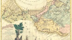
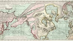
Engraved hand-colored in outline, double-page map of the northwest coast of North America and northeast Asia including the North Pacific Ocean to the Bering Strait and the Kamchatka Peninsula. Alaska shown by a group of islands off the coast of Russia, identified as Isole Alessiane. There is a notation of the Chinese colony of Fou-Sang in the vicinity of Vancouver Island. Map shows political divisions, cities, towns, coastal towns, mountains and rivers. Relief shown by hachures. includes decorative title cartouche and notes.